Scott’s Big Adventure, Day Sixteen: Springerville to Benson [feat. The Coronado Trail]

Day Sixteen dawned with clear blue skies, calm winds, and perfect temperatures. Time to ride!

Ride Through the White Mountains on the Coronado Trail

I headed south from Springerville on Highway 191, which heads up into the White Mountains and continues south hugging the far eastern side of Arizona. Apparently the White Mountains are a popular summer vacation area for people seeking to escape the heat of Phoenix. I saw lots of resorts and recreational areas as I traveled along Hwy 191, especially at the northern end just south of Springerville.

As I continued further south and got higher up in the mountains, the road turned into a twisty, windy roller coaster. This part of the ride was a lot of fun, but there isn’t a lot of video or pictures to show for it because I was too busy trying to stay on the road to bother much with those. I’m glad I waited an extra day for the weather to blow over. Riding this road in high winds and rain would have been risky. A lot of the curves had no guard rails; one false move and over the edge you go. But once I got into the rhythm of braking and turning and accelerating, it was a blast!

This road is called the Coronado Trail Scenic Byway because the Spanish explorer Francisco Coronado lead an expedition up this way from Mexico in search of the golden city of Cibola in 1540. He never found Cibola–because it doesn’t exist–but instead ended up crossing modern-day New Mexico, Texas, and Oklahoma, reaching eastern Kansas before returning to Mexico. As I was riding this roller coaster, I kept thinking that poor Coronado could have found an easier way.

Massive Open Pit Copper Mine in Morenci

As you come out of the mountains at the southern end of the range, you encounter a MASSIVE open pit mine. This things must measure so 5-miles long (N-S) and a mile or two wide. The rode winds right through the middle of it, with fences on either side to keep visitors out. There’s one spot where you can watch these huge dump trucks being loaded and driven out of the pit up the side of a hill. They look like ants but when you are right beside them you realize that they are gigantic.

Here’s what it looks like from space:

I learned later that this is the largest copper mine in the world. I should say so. Gone are the days of the lone prospector with his wooden-shored mine and donkey-powered equipment. This is mining on an industrial scale. Passing through the company town of Morenci, I saw a train on a siding with nothing but tanker cars–at least 50 of them–full of sulfuric acid, which is used to extract the metal from low-grade ore. I wonder what happens to the waste?

Run in to Benson

Continuing on, after you get out of the foothills, the highway angles off to the southwest towards the town of Safford, which is pretty much the big city in this part of the state. This area is the upper end of the Gila River valley, so its pretty well irrigated and cultivated, and here’s where I found something surprising: They grow cotton here. Lot’s of it. Pretty much all of the fields I passed on the way into Safford where planted with cotton. I’d never actually seen cotton growing before with my own eyes, but there it was.

In Safford, I made a little navigational boo-boo and headed off in the wrong direction for a little white. I should mention that the Magellan GPS unit that I have leaves a lot to be desired for this type of travel. Among its other flaws is that it is practically impossible to see during the day due to the color scheme that they chose to use. Lots of pastels including some which are very similar in color. If I shade it with my hand, I can read some of the information, but if I want to see everything, I have to pull off the road and find a spot out of the sunlight. There’s no way to modify the color scheme. Bad design.

Anyway, I missed a turn in Safford and ended up going the wrong way for about 10 miles. A road sign told me I was headed for Phoenix. I checked the GPS and found it wanted me to make a u-turn, so I did. Got back to Safford, got on the right road, and that was that. The “right road” is still Hwy 191, which takes you directly south from Safford, and intersects Interstate 10. Getting on I-10 from this point takes you to the southwest in a loop around a mountain range, and eventually lands you in Tucson. At the bottom, or southernmost, part of the loop is the little town of Benson, which was my destination for the day.

Benson is yet another of these little mining towns, all of which were founded at around the same time, 1880 give or take a few years. Benson is about 20 miles north of Tombstone, which was where I was actually headed. But I try to stay away from spending the night in these tourist towns because the jack up all the prices.

Day Seventeen: Tombstone and vicinity.

Scott’s Big Adventure, Day Fifteen: Storm Layover in Springerville Arizona

I had pretty much decided this last night, but once I got up in the morning and took a look outside, I decided for sure: I’m not going anywhere today. I woke up to a full-bore thunderstorm, complete with thunder, lightening, heavy rain, high winds, the works. It lasted for about a half-hour, then it cleared up for a little while, then the next storm moved in and the cycle repeated itself. By the time I had gotten showered and dressed, there had already been three of these thunder-showers moved through the area. And by the end of the day, there had been at least a dozen–if not more–repetitions of the cycle.

During a sun break in the pattern, I walked down the street to a place called Java Blues. Expecting a simple, but civilized, coffee shop, instead I was greeted by a full blown cafe with a sit-down bar and lots of tables scattered around a renovated old house. There even was a full bar in the back half of the building. A lot of locals where in and out during the time that I was there. I ended up staying for both breakfast and lunch, not leaving until after 3pm in the afternoon. I tried as best I could to get caught up on my blog entries, as well as get a bunch of photos tagged and uploaded to Flickr.

It’s about 10pm right now as I write this. The skies have been clear since just before dark. The wind still flares up and shakes things around a bit every once in a while. The forecast for tomorrow calls for partly cloudy with only a 10% chance of rain in the mountains where I’m going, and calm winds. So it looks like I’ll be off again tomorrow to continue with Scott’s Big Adventure.

Scott’s Big Adventure, Day Fourteen: Holbrook to Springerville [feat. The Petrified Forest]

The wind was still howling on Day Fourteen. The plan for today was to visit the Painted Desert/Petrified Forest, and then figure out the best way to get to the southern part of the state.

Painted Desert

There are several areas around this part of Arizona which are called Painted Desert. All it means is that there are exposed mineral deposits which are (mainly) bright red and in some cases green. This particular Painted Desert is a part of The Petrified Forest National Park. It’s got nothing in particular to do with the Petrified Forest, its just in the same general vicinity so they added it to the Park.

The north entrance to the park, and the Painted Desert section, are north of I-40. This Painted Desert is a U-shaped valley running south-to-north-to-south and right-to-left. The beginning (right) of the valley is predominately red, and as you move to the north and left, the red fades off into the distance and the end (left) of the valley is predominately green and gray. All this is in contrast to the normal tan or brown color of the rocks and hills. Its also different from the red rocks of Monument Valley and Arches. These are small, rounded hills which instead of being brown, are red instead.

About midway around the valley, up on a bluff, is an old Inn, which is now a museum/gift shop. The view from there is pretty good. Overall, I wasn’t very impressed with this area. Its very similar to the Painted Hills in central Oregon. Its another one of those places which look bigger and more impressive on film than it does in person. When you’re standing there looking at it, you realize that the hills are only 20, 30, maybe 50 feet high, but they look hundreds of feet high in photos. Its because there are no points of reference, so your eye assumes that things are bigger than they really are.

Petrified Forest

The road through the park crosses over I-40 and heads south into the Petrified Forest section of the park. There are about 5 or 6 attractions scattered over about 20 or 30 miles of park. I didn’t visit all of them, but the first one that I did check out was Newspaper Rock. This consists of several large, flat rocks at the bottom of a ravine which are completely covered with petroglyphs. Scientists think that this was a centrally located place for local paleo-indian tribes to post news. Or many be it was just a bunch of paleo-vandals tagging these particular rocks. Who knows.

The next spot was the Agate Bridge, which is a fallen petrified log which has had the rock underneath it eroded away. The result is a bridge that you can walk under…if they Park Service were to allow it, that is. As usual, everything is off-limits. Stay behind the railing, please. Don’t touch.

Most of the other attractions are “Forests,” which are just areas which have a whole bunch of petrified logs laying around. These forests were heavily plundered in the years after they were discovered before the Park was formed. A lot of the best, most interesting logs are gone. What’s left is still pretty cool, though.

Petrified wood is formed when trees are covered by sediment which eventually hardens into rock. Minerals seep into the wood, and as the wood rots, the minerals displace the wood but retain its shape and texture. After millions of years, these logs are exposed due to erosion, resulting in these large fields of rocks laying around which look at first glance like there are wood. But upon closer inspection, you can see that they are in fact, rocks. Pretty rocks, too. Pictures to follow sometime.

Show Low

I left the park via the south entrance. All this time the winds continued to blow. I was a little undecided as to which route to take to get south. I decided to head first for Show Low, about 50 miles away. My ex-mother-in-law owned property there, and I was a little curious to see what the area looked like.

Leaving the National Park, the surrounding area is basically rangeland, which eventually gives way to juniper bushes and pine trees as you move south. The area also turns hilly as you approach the White Mountains. I was never quite sure where the property was located, but I did notice that there was a LOT of land for sale in that area. Some of it was in “developments,” and some of it was just open rangeland, but there were lots of For Sale signs. And none of it, in my opinion, was particularly attractive. It was a nice area, but there is NOTHING there.

Show Low is a typical mid-size town. It had a nice little coffee shop where I stopped to look at the map and have a bagel and a cappuccino. I decided to head down the Coronado Trail on the far eastern side of the state. But, the locals were all talking about a storm heading in this direction. The wind out of the south was already making it very hard for me to ride. So, as a first step, I decided to head east towards the start of the Coronado Trail which is at a town called Springerville.

Springerville

Springerville is a pretty small town. Its got a twin called Eager right next door, where you can’t tell when you leave one and enter the other. I stayed at a cool, old restored motel called Reed’s Lodge. There were a bunch of other bikers staying there as well. All of the talk was about the weather. Just down the street was a coffee shop/cafe/bar called Java Blues. Which I’m definitely going to visit in the morning.

Storm Coming

The forecast for the White Mountains to the south–right were I’m heading–is for continued high wind with the addition of thundershowers. A storm front out of the Pacific coast of Mexico is coming up from the south. The bulk of it will past to the east into New Mexico and Colorado, but the trailing edge of it still could cause problems in eastern Arizona. I’ll decide in the morning whether or not to proceed.

Scott’s Big Adventure, Day Thirteen: Kayenta to Holbrook [feat. Meteor Crater & a Corner in Winslow]

Day Thirteen was primarily a travel day, getting from one side of the Navajo Reservation to the other. The main attractions of this day were to come in the afternoon, but not before the weather took a turn for the…unexpected.

Indian Country

Kayenta is at the far northern edge of Arizona, and my next destination was more towards the middle of the state. I had the choice of which route to take. The more direct route would have lead me through the heart of the Navajo Reservation towards Winslow, but I decided to take highways 160 and 89 into Flagstaff instead. Flagstaff is somewhat out of the way, but I decided to do this because of the condition of the roads on the reservation. They are okay for car travel, but they have a lot of breaks and repairs, which makes for a very bumpy ride on the Vespa.

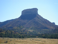
Leaving Kayenta on Hwy 160, you pass Black Mesa on the left. Its called Black Mesa due to its abundant coal deposits, and I saw lots of evidence of coal mining along the way. By the way, traveling through this part of the country, it quickly becomes apparent that mining is a very important part of the economy here. It was the reason that this area was settled in the first place, because Lord knows that nothing much will grow around here.

Before too long, you come upon the Hopi Reservation, which is entire surrounded by the Navajo Res. Hwy 160 skirts the edge of the Hopi Res., so I didn’t see much of it, but I understand that the Hopi people have traditionally lived on a series of mesas—dubbed First, Second and Third Mesa by the Spanish—in the middle of their reservation. In contrast, the Navajo tend to live in small, isolated communities scattered throughout their much larger reservation. Interesting how two peoples who lived in such close proximity to one another developed such different social structures.

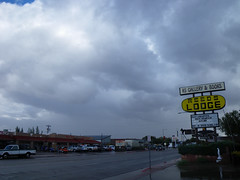
Just before hitting Hwy 89, you pass through a town called Tuba City, but there are no big brass instruments that I saw. The town, though apparently on Navajo territory, is named after a locally famous, nineteenth century Hopi chief named Tuuvi. A road from Tuba City leads into the heart of the Hopi Res., and to the largest town on the res., Second Mesa. There is a beautiful new “Travel Plaza” there, which is intended to entice visitors into “Hopiland.”

Travel plazas are something that we don’t have in Oregon and Washington, at least not on the same scale. I’ve noticed these things all over the Southwest. The area is sparsely populated and the towns tend to be widely spaced apart. In each of these little towns, there now appear to be these “travel plazas” which look like they have mainly replaced a number of older businesses. A travel plaza is usually a single business which combines a gas station, a convenience store, a gift shop, and one or more fast food outlets, all under the same roof. The idea is that you stop for gas at one of these places, and you can attend to all of your roadside needs at a single location. I’ve see these plazas with McDonalds, Taco Time, A&W and a host of other franchise brands. Usually these are “express” versions of the franchise, with only a small counter and a truncated menu. It takes a little getting used to, but it seems to make a lot of sense.

Flagstaff

You leave behind the Navajo Reservation about 50 miles north of Flagstaff. As you approach Flagstaff from the north on Hwy 89, the San Francisco mountain range looms into view. Flagstaff is on the other side of the range. about 25-30 miles north of Flag, I started running into a very heavy headwind directly from out of the south. This made the going very slow, because in addition to having to fight the wind, I was also gaining altitude into order to go over the San Francisco range. At times I could only muster 40 MPH on a highway were the speed limit was 65. I learned later that the wind was the forerunner of a big storm that was brewing out off the Pacific coast of Mexico, in combination with a big low pressure area sitting to the north of me over Utah.

Getting close to Flagstaff, it started to get really hazy, and when I finally get into the mountains, I could see—and smell—that there was a forest or range fire burning somewhere close by. I finally spotted the source, which was just north of Flagstaff. I don’t know if it was accidental or a managed burn, but I’m sure that the wind wasn’t helping it any.

Once I got into Flagstaff itself, I stopped for coffee and a bagel at a little cafe downtown called…I forgot!. Downtown Flagstaff has been made over into a nice little shopping and restaurant district. The place where I had coffee was in a little alleyway not unlike Post Alley in Seattle, only not nearly as developed. The wind was still howling, which kind of diminished the experience, but still it was pretty pleasant. Afterward, I rode up the hill to do a quick drive-by visit to the Lowell Observatory, in honor of my friend Doug Lowell, who is a descendant of the famous astronomer Percival Lowell. Lowell did some for the first detailed studies of Mars and was instrumental in the discovery of Pluto.

Riding Sideways on I-40

After lunch, I headed east on Interstate 40, the only available route, towards Meteor Crater. By this time, the wind had really picked up. I learned later that there were sustained winds of 35-40 MPH, with gusts up to 60 MPH. With me heading east and the winds out of the south, that meant the I pretty much spent the next hour or so riding sideways, leaning over to my right. That was the only way to stay on the road. If I tried to ride straight up and down normally, the wind would blow me over to the left. It felt a little weird to be oriented that way, but the wind coming from my right kept me from falling over. The biggest challenge came when something blocked the wind suddenly and temporarily, like a hill or a truck or an overpass. Then my prop would suddenly disappear and I would struggle to remain upright until the wind reappeared. I don’t think that I’ve ever gripped the handlebars so tightly for so long. After a while I got used to it and could relax a bit. But only a bit.

Meteor Crater

I got to Meteor Crater in the middle of the afternoon. It cost $15 (!) to go in. The crater is on private land. The original discoverer filed mining claims, thinking that he was going to hauling out pure iron by the wagon load. That didn’t happen, but the way that mining law works, if you work the claim for so many years, then the government deeds over the land to you. So even though they didn’t find the motherlode of iron, the tourist business proved to be more lucrative in the end. The reasons why they didn’t find all the iron they expected was because: (1) part of the meteorite vaporized upon impact; (2) it apparently shattered into several pieces just before impact (some pieces were found miles away; and (3) it came in at a slight angle so that the remaining iron is buried underneath the south rim of the crater rather than in the center of it where they were drilling their mine shafts.

This is one of those weird places that looks very different in person than it does in photos or on film. The crater is 1 mile in diameter, but when you stand on the rim looking at it, it looks much smaller than it does in photos. In photos, the thing looks enormous, but in person, it looks only about the size of a couple of football fields. This is something of an illusion because there is nothing in the crater itself that you can use for a visual reference. By the way, Apollo astronauts trained here because it the freshest and best-preserved example of an impact crater on earth. And by “fresh,” I mean that it is only 50,000 years old and hasn’t had time to erode away yet.

Winslow Arizona

About 10 miles to the east of Meteor Crater is Winslow, Arizona, a dreary little town that doesn’t seem to have much going for it any more. Route 66 used to run through the middle of town, but I-40 bypassed it, so now all of the economic activity is centered around the freeway exits and the town itself seem half dead. But, right on the old Route 66 in the middle of downtown is a little park on a corner which commemorates the Eagles song Take It Easy.

One of the interesting things to me about the park is that there is absolutely no mention of The Eagles, Glenn Frey or Jackson Browne (the songwriters), or the song itself or its title. Its completely copyright-lawsuit-proof! But right across the street is a tourist-trap gift shop which has Eagles songs blaring out on a loudspeaker.

The park consists of a painting on the side of a building which depicts a girl driving a flatbed Ford truck, and looking over at a statue of a musician holding a guitar, which is said to look a lot like a young Jackson Browne, who co-wrote Take It Easy with Glenn Frey. I hung out at the park for about a half-hour, resting. I watched a bunch of tourists stop by, get out, take pictures, and leave. During all this time, not one of them noticed that, parked on the street right next to the park was a real, red flatbed Ford truck, just like the one in the picture. I got a real kick out of that. Open your eyes, people!

One of the people who stopped by the park was a tour operator who was shepherding around a group of travel writers. He talked to me a bit about my Vespa, and also told me about the La Posada Hotel just down the street. I went there and found a beautiful, recently-restored old railway hotel designed by Mary Colter, the architect who designed most of the structures at Grand Canyon NP as well as many other buildings all over the Southwest.

A railroad hotel is one which is right next to the train station. A traveler would get off the train and walk right over to the hotel to spend the night. The front door faced the train tracks rather than the street. These were first class accommodations targeted towards the upscale passengers. They fell into disuse after the automobile displaced trains as the dominant means of travel. Not many of them still exist, and the La Posada is one of the most beautiful and best-preserved. I was going to stay the night there, but unfortunately they were booked, so I moved on to Holbrook, Arizona, just down the road about 30 miles.

The Wigwam Motel in Holbrook

I got off the freeway and onto the business loop of I-40 going into Holbrook. In most of the towns along I-40, the so-called “business loop” is actually the old Route 66. There coming into town from the west, on a dilapidated stretch of road sat the Wigwam Motel, still in operation. This is the place that has concrete Tepees for motel rooms. This is parodied in the movie Cars by the motel with large traffic cones as the rooms. Like I said, the area around the motel is pretty rundown, and the Wigwam itself is no spring chicken, but its still there and still running. In fact, I was going to spend the night there, but it too was booked, and I ended up spending the night at a modern motel on the other end of town.

On tap for Day Fourteen: The Petrified Forest.

Scott’s Big Adventure, Day Twelve: Cortez to Kayenta [feat. Four Corners & Monument Valley]

Leaving Cortez just after 9am, there were two destinations on the agenda for today. First was Four Corners Monument and second was Monument Valley. The only real decision was whether to drive through Monument Valley from south-to-north, or from north-to-south. The main consequence was which town I would be spending the night in. After consulting with one of the Navajo jewelry vendors at Four Corners, I decided on north-to-south, spending the night in Kayenta, AZ, or “K-Town” as the Navajo call it.

Four Corners Monument

Four Corners Monument

The is the place—the only place in the USA, actually—were 4 states all come together and meet at a single point. This happens due to the fact that the borders of all four states are straight lines and cross in an “+” pattern. The states are, in clockwise order starting in the upper left, Utah, Colorado, New Mexico and Arizona. Hwy 160 comes in from Colorado on a NE-SW line, clips across the extreme NW corner of New Mexico for no more than a mile, then continues on into Arizona. Right in the middle of the New Mexico segment, an access road leaves the highway and runs to the NW for about a quarter-mile to the monument itself.

The monument is on Navajo land, so they own and operate the park. There is a nominal fee to get in. Right at the point where the four state’s borders meet is a raised platform surrounded by the state’s flags and seals, and right in the center of the platform is a small brass plaque set in the ground marking the exact point where the four states meet. Off to one side is a raised wooden platform where one can take photographs of one’s friends and/or relatives sitting, standing, kneeling, squatting or doing something else in all four states at once. I only took 3 pictures here; there just isn’t that much to see. Surrounding the platform is a gravel parking lot, and surrounding the parking lot is a ring of booths where Native American vendors sell various arts and crafts and foods. Kind of like Saturday Market only all in a big circle out in the middle of nowhere. I bought a bunch of souvenirs here, so if you receive one from me, well, I hope you like it.

Monument Valley

Merrick Butte

Based on the advice of one of the Navajo vendors at Four Corners, I decided to loop around and come into Monument Valley from the North. I headed for the northern end of Hwy 163 and the little town of Mexican Hat. This town is named after a balanced rock formation north of town, which looks like a head wearing a sombrero. The town itself is a small, dusty place with a couple of motels and a cafe. I stopped there for lunch, and had an order of chicken stripes which was the worst that I’ve ever hand.

Leaving Mexican Hat, its about 10 miles until you get to Monument Valley. You can see the buttes in the distance as you’re driving, which looks kind of cool. I was on the lookout for this one particular stretch of the highway which you see a lot in movies and on TV. Here’s picture of it that somebody else took which you’ll probably recognize right away. Anyway, as I drove over it, I didn’t recognize it. I was looking for something much more grand. It turns out that I did actually get a picture of the road, but it was totally by accident because I had stopped to get a shot of the monuments in the distance. Its just another example of how film, both still pictures as well as movies and videos, really don’t present an accurate portrayal of real places.

As I rode into the place on the map called “Monument Valley,” I learned that there are really two Monument Valleys. The first is the big area called Monument Valley, which includes a town, a high schools, a resort motel, gas stations, homes, scattered ranches, and so on. Pretty much everything you would expect in and around a normal dot-on-the-map town. This area also contains lots of buttes and mesas that are beautiful and photogenic. But the Monument Valley of film fame is located off to one side of the main valley, and is contained within the boundaries of the Monument Valley Navajo Tribal Park. This is pretty similar to a normal U.S. National Park, only its run by the Navajo Nation instead of the U.S. government. There’s an entrance fee. and a visitor’s center, and concessionaires selling tours and trinkets.

The main attraction is a drive through the valley itself, which is a 17-mile loop road going past all of the famous landmarks that you’ve seen on film and television. The unfortunate thing for me is that the loop road is unpaved, and the Vespa is not an offroad vehicle! But, I gave it a try anyway. The first part of the road was pretty smooth. Just packed dirt and an occasional rocky patch that I could easily ride around. After a little ways in though, it got rougher and rougher. Nothing a normal car couldn’t handle, but it sure bounced me around quite a bit. I was sure that things were going to start falling off my scooter, but it actually held together pretty well.

I ended up going in about 4 miles to John Ford’s Point, then I decided to turn around and come back, mainly because it was getting dark and it would be hard to see all the bumps in the road on the way back. I ended up seeing most of the recognizable landmarks. I’ve never seen the John Wayne movie The Searchers, in which John Ford’s Point figures prominently, so I’ll have to rent that when I get back. The only thing that I didn’t see that I had wanted to was The Totem Pole, which Clint Eastwood and George Kennedy—or their stunt doubles— climbed in the movie The Eigar Sanction.

By the time that I got back to the visitor’s center, it was dusk. I got back on Hwy 163 and headed out south. If there was anything interesting to see in the south part of the big Monument Valley, I didn’t see it because it was dark. According to the maps, I don’t think that there was. After about 20 miles or so, I entered the town of Kayenta and spent the night at a ridiculously overpriced Holiday Inn.

Scott’s Big Adventure, Day Eleven: Moab to Cortez [feat. Mesa Verde]

Mesa Verde Park Entrance

Got up bright and early on Day Eleven and headed south out of Moab. The weather was perfect: sunny and clear with temperatures slated for the high 70’s. Couldn’t ask for better. I had initially planned to blitz right down to Four Corners today, but based on recommendations from other travelers, I decided to swing over into SW Colorado to check out Mesa Verde. But first…

Hole ‘n the Rock

This is the coolest place. Back before World War II, a local mining engineer and his wife acquired this big sandstone bluff right off the road about 15 miles south of Moab. They blasted a cavern out of the side of the bluff, and in it built a cafe, which they operated for many years. At some point, they decided to enlarge the cavern and live there, and in the late 40’s and 50’s they did just that, eventually blasting out a 5000-sq-ft home in the rock. The husband died in 1957 (I think), and the wife followed sometime in the 60’s or early 70’s (I think). They are laid to rest in a small cavern which they blasted out just for this purpose.

Today, Hole ‘n the Rock is a full-blown roadside tourist attraction. It cost $5 per person for a guided tour inside the “house” and its well worth it. They also have a website which has some interior photos of the cavern. The place is fully functional and homey. They don’t allow photography inside the house, so I bought a little folder of photos for about $2. There is also all kinds of roadside memorabilia on display outside on the grounds. If you ever drive through this way, its definitely worth an hour of your time to check it out.

Road to Cortez

Continuing south on Hwy 191, as you approach the town of Monticello you see off to the right a small mountain cluster centered around Abajo Peak. Unlike the surrounding range land which is pretty brown, this mountain is covered with a variety of both evergreen and deciduous (those that loose their leaves) trees. Given the time of year, the mountainside was a beautiful mixture of colors. I couldn’t keep my eyes off of it as it grew bigger and bigger as I approached Monticello.

I gassed up in Monticello, then turned off east on Hwy 491 towards Cortez, Colorado. Hwy 491 used to be designated as Hwy 666, and runs through parts of Utah, Colorado and New Mexico in the Four Corners area. Due to its numeric designation as well has the high fatality rate, it earned the nickname “Devil’s Highway,” and many people believed that it was cursed. In addition, the highway signs were stolen regularly, leading to the highway departments of the effected states to request that the highway be re-numbered.

Problem solved. After turning east at Monticello, I could see two snow-capped mountain groups, one to the north and other other to the south. I’m not sure what they are called. Google Maps isn’t any help because there are too many choices and I can’t tell which ones I was looking at.

Cortez itself is a fairly non-descript medium-sized town. I passed through quickly and headed straight east to the entrance to Mesa Verde National Park.

Mesa Verde

I didn’t realized it while in Cortez, but the entire line of hills to the southeast of town comprises Mesa Verde. It doesn’t look like a mesa from the west because the abrupt drop-off typical of a mesa is on the eastern side. You enter the Park from the northern end. There is a very prominent peak right at the park’s entrance which looks pretty cool. Again, perfect place for a lookout post. You climb up onto the plateau, then head south for about 20 miles or so, where all the really interesting stuff is.

The basic story of Mesa Verde is that, beginning about 1500 years ago, it was home to a group of Native Americans whom we call Anasazi or Ancestral Puebloans. For reasons unknown, these people moved to the top of the mesa and established settlements and raised crops. They went through a secession of development steps, first building and living in underground dwellings, then progressing to above-ground adobe buildings, and finally to cliff-side adobe structures.

Spruce Tree House at Mesa Verde

Its these cliff-side dwellings that are both the most amazing feature of Mesa Verde National Park, as well as the most mysterious. Why did these people, around the year 1100 or so, abandon their mesa-top villages and build these difficult-to-access towns in alcoves of the cliffs around the eastern edge of the mesa? They continued to farm on the mesa-top, but had to climb up and down the cliffs using precarious finger and toe holds which they chipped into the cliff-side. Talk about having to be in good shape! I wonder what happened to people where injured and couldn’t climb?

The usual theory for the move to the cliffs is that the Anasazi were under threat from some other group, and that the cliff-side dwellings were build for defensive purposes. But there is no evidence to support that theory: no battlefields, no petroglyphs, no nothing. They just moved, and nobody really knows why. Then, after living on the cliff sides for less than a hundred years, the people abandoned the mesas entirely, and apparently migrated down onto the lowlands and merged with the peoples who were already living there. This time, however, the reason for moving isn’t so mysterious. Scientists believe that there was an extended period of drought in this part of the country—we’re talking 20 or more years here—and that it probably became too difficult to sustain crops on the mesa-tops. So the people moved and blended into history, leaving behind these spectacular dwellings for us to marvel at.

Back to Cortez

By the time I was finished checking everything out at Mesa Verde, it was starting to get dark and I still had a 20-mile up-and-down-the-canyons ride back to the park entrance. I had earlier entertained thoughts of getting down to Four Corners before the end of the day, but that plan was out the window, and would have to wait for Day Twelve. So back to Cortez to find a motel for the night.

Scott’s Big Adventure, Day Ten: Inside Arches National Park

Scott's Vespa at Arches

This should be a short post. I pretty much spent the entire day inside Arches National Park just north of Moab Utah. The pictures will tell the story of this breath-taking place. I had intended to get up early and beat the crowds and the heat, but instead ended up sleeping until about 11am. I didn’t leave for the park until about 1:30pm. Since I was intending to spend another night here, I stripped all of the luggage off of the Vespa and went to Arches in shorts and a t-shirt. I also planned on being back by sundown.

BTW, the weather has been perfect since the storm blew through. Temperatures have been in the high-70’s and low-80’s. But it does get chilly at night.

Arches has four—more or less—main areas where there are interesting rock formations. Not everything in Arches N.P. is an arch. There are plenty of spires, fins, balancing rocks and so on.

The first main area is just inside the park at the top of the plateau. There is a view point where you can see the La Sal mountains to the southeast, the Colorado River canyons to the east, the “Windows” area to the northeast, and the first set of monuments to the immediate north. Those first monuments do not include any arches. They are “just” large rock monoliths that seen to rise out of the desert sands and soar to heights of several hundred feet. (As an aside, I noticed something peculiar about these rock formations. From a distance, they look huge. But when you get right up next to them, you realize that they aren’t as big as you thought. There’s nothing for your brain to compare them with, so it defaults into making you believe that they are enormous when in fact many of them are only 50-100 feet high.)

The second main area included Balanced Rock and the Windows arches. Balanced rock is a large boulder that is sitting atop a spire, supported by a relatively thin layer of sedimentary rock. This sedimentary layer will erode faster than either the boulder or the spire, so the Balanced Rock will eventually fall. In the mean time, it just looks like it might fall at any minute. Further on are the Windows arches along with several other arches in the same area. The Windows are two arches in the same rock wall, one to the north and the other to the south, that resemble very large windows in a wall.

The third main area is the Delicate Arch and a little further on, the Fiery Furnace. Delicate Arch is the most photographed arch, and is used in most of the promotional materials. If you recall seeing a picture of an arch representing Arches N.P., it was probably Delicate Arch. You can get right up close to it after a brisk 1-1/2 mile hike, or you can do like I did, and take a somewhat-less-brisk 500 yard hike and take pictures of the arch with your telephoto lens.

The fourth main area is called the Devil’s Garden, and it includes a large number of arches along a trail stretching several miles. The most spectacular of these is the Landscape Arch. A little further on along the trail is the Wall Arch, which collapsed just last August. Also in this area is the campground.

The sun had gone down beyond the canyon rim by the time I got to Landscape Arch, so I decided to call it a day at that point and I turned around and started heading back. On the way back to the parking lot, I stopped to take a shot of the sun on a distant canyon wall. As I brought down the camera to look at the picture I just took, I noticed that only about 40-50 feet in front of me were 5 mule deer munching on the foliage. I moved a bit further down the trail for a better vantage point and took several shots of them. As they moved around in the bushes, one of them approached to within about 10 feet of me. I just stood still and took pictures. As people came down the trail after me, I motioned for them to be quite and pointed to the deer. Pretty soon there were about a dozen people standing there taking pictures of these 5 deer. After a while, they moved off and I moved on down the trail.

By the time I got back to the parking lot, it was dusk and getting cold. I had on only a t-shirt and shorts. I had a fleece vest in the trunk so I put that on and started back to towards the entrance. A quarter moon was out in the south and the sky was full of stars. When I rode by Balanced Rock, I could see it clearly silhouetted against the night sky. I stopped and set up the tripod and took a few pictures. I had to wait quite a long time to get some good shots because of all cars driving by trying to get out of the park. As the cars approached the spire, their headlights would illuminate the rock, ruining the shot. And of course, the cars were perfectly spaced so that it was impossible to get a shot in-between them. Anyway, I hope some of them turn out.

I ended up getting pretty chewed up by mosquitoes, which is weird for two reasons: first, they usually don’t like the taste of me; and I didn’t notice them at all. But by the time I got back to the motel, I was scratching both my arms and my legs. I jumped into the hot tub and tried to forget about the itchiness.

Tomorrow: Southeast to Mesa Verde in Colorado.

Scott’s Big Adventure, Day Nine: Salt Lake City to Moab

Got up at the usual time and found that it was raining, just like the day before. The forecast for central Utah called for showers, so I dressed for a rain day. Took my own advise from yesterday and dressed slowly. Worked much better. By the time I was ready to leave, I was warm and dry and ready for nature’s worst. But nature has a sense of humor…it stopped raining right when I left to hotel.

IMG_0530.JPG

I dropped by a Best Buy and bought some recordable DVDs so that I could archive some of the video that I have been shooting, but not editing and posting. The hard drive partition that I had set aside was already full.

Headed south to Provo. Rode past BYU. Nice campus. South of Provo, the highway heads towards Moab, Hwy 6 and others, goes up over a mountain pass and then down into central Utah. The rain the day before had dusted the mountaintops with snow, but it was still pretty cloudy so visibility was spotty. At the entrance to the pass, there is a phalanx of power-generating windmills, just like I had seen from afar on in the Columbia Gorge. The road went right past these, and boy are they big! Couple of hundred feet high I’d guess.

The highway drops down out of the mountains and into a little mining town called Helper. I took the cutoff and drove though the town just for kicks. It was kind of sad to see. Mining had declined considerably in that area, and the town of Helper, which obviously had been quite the place in its heyday, was clearly dying.

Continuing on, the highway heads out onto a plateau. I gassed up in the town of Wellington. Just outside Wellington, right in the middle of passing a big, gas-guzzling RV, the engine died. I pulled over to the side of the road, praying that the problem was a loose spark plug wire. Unloaded everything to get to the engine compartment, peaked in and sure enough, there was the spark plug wire dangling loose. So I stuck my hand down there to put it back and—YEOUCH!—got burned by the hot engine…duh! So I had to wait about 15 minutes for it to cool down enough to put the cap back on. Then I was back on my way.

As an aside, there I was, out in the middle of nowhere, with all the stuff off of my bike, and my head stuck down in the engine compartment, for about 15-20 minutes. At least 50 cars and trucks went by during that time, and NOT ONE stopped to see if I was okay or needed any help. That’s comforting.

By this time, the sun had broken out and the clouds were clearly dispersing, so I got out the video camera and started recording again. I had dodged showers throughout the day so far, but it looked like it was clearing up for good. Continuing on, there is a pretty dramatic-looking mountain range that parallels the highway on the left. Not sure what its called, but it had a couple of peaks that would have made really good lookout positions.

BTW, all during the section of the ride, I kept thinking about the old westerns that I had seen, and thinking that all these canyons that I was riding through would have made really good ambush points, and that these mesas would have made really good lookout positions. When you see these places on film, they look flat. But when you seen them in person, you get a real sense for how the Indian wars would have played out.

When you round the southern end of the range, the highway meets up with Interstate 70 in a town called Green River. It was there that I noticed a rather large rain cloud away to the south that was moving west to east like I was. It was headed right for Moab just like I was. The race was on!

I-70 was practically deserted, so I made pretty good time to Crescent Junction where Hwy 191 branches off toward Moab. As you approach Moab, the road starts to descend into a canyon. Off to the left, I could see this really dramatic-looking red rock formation, which I learned later was the Devil’s Garden area of Arches National Park. Off to my right, that big rain cloud was getting closer.

I pulled into Moab at the bottom of the canyon, cruised up and down the strip once or twice, and found a nice motel. I checked in and got all my stuff off the bike. By that time, the sun had just gone down behind the canyon walls, and the rain storm was approaching. I took a couple of really cool pictures of the storm as it approached, which I’ll post soon (yeah, right). It rained for about and hour, and then it stopped and started drying out.


Polygamy Porter label

Went to a local cafe for dinner, and had a Scorpion Ale. Pretty good, but not as good as Polygamy Porter (“Why have only one?”). The plan for tomorrow—get up early and head into Arches!

Scott’s Big Adventure, Day Eight: Jackson Hole to Salt Lake City

What a miserable day! First, the town of Jackson is yet another tourist town, with lots of shops catering to the same. I had dinner at the Cadillac Grille and watched some of the Boston v. Anaheim playoff game. Had a Moose Drool brown ale, which, in addition to its catchy name, actually tasted pretty good. Brewed somewhere in Montana.

The next morning (Day Eight) it was raining with the temperature in the mid to upper-40s. Just about what I was expecting from the forecast. However, the forecast for Salt Lake City called for occasional showers with temperatures in the 70s, so I was hoping that the weather would clear and warm up as I traveled south from Jackson.

For the first time I had to get out all of my rain gear and warm clothing, and put them to use. Right off the bat, I learned a very important lesson: it takes a while to get all of the layers of the riding outfit on, and you expend a considerable amount of effort and energy in doing so. By the time you’re done, you are hot and sweaty and very uncomfortable. At this point you basically have two choices. Either you take some of the stuff off, which you will regret as soon as you get going, or you grit your teeth and live with it. I choose to do the latter.

Here’s where the second lesson of the day begins: Once you’ve gotten hot and sweaty underneath all of those layers, you are going to remain uncomfortable from quite a while, until the moisture gets wicked away from your body. Once it does, you won’t feel so sticky inside your clothes. But underneath all of those layers, there is no place for the moisture to go, so it remain in one of the middle layers, where it eventually cools and starts making you cold.

Lesson number three: Layering your clothes is intended to keep you warm by trapping your body heat within the layers of clothing. But your body doesn’t generate much heat just sitting on a scooter. In my case, the cold, wet middle layer won out over the not-much-generated body heat, and I was chilly the whole day. Not bad, mind you, but certainly not toasty warm like I was hoping to be.

So what did we learn here. First off, I need to choose my layers more carefully given the weather conditions. I think I would have been better off having fewer layers than I did, which would have made it faster and easier getting into everything to begin with. Second, I think you need to put your stuff on outside in the weather, ideally under cover of course, and to take your time doing it. Put the layers on one at a time, and allow time for your body to get used to the change in temperature. And use the least amount of effort as possible so that you don’t start sweating.

By the way, this situation is very similar to when I learned to SCUBA dive in Puget Sound. The water in Puget Sound is cold enough that you need to wear a wetsuit (or a drysuit, but those are expensive), but the wetsuit is very difficult to put on because it is skin-tight neoprene, and it traps your body heat and makes you sweat profusely while on land. The trick is to put on the pants while on the beach, using the least amount of effort as possible, then get in the water and put on the rest of it there.

As for the ride itself, it rained the whole way from Jackson down to Salt Lake City, and the temperature, which started out about 48-degrees, dropped down to about 42, and never got above 50 until right before getting to the Salt Lake basin, where it got all the way up to about 53. And did I mention that it rained the whole way? Mostly it was just a steady rain, but a couple of times it just opened up and poured for a few minutes. And several times I got splashed by cars and trucks driving through a big puddle going the opposite direction. It felt like somebody through a bucket of water in my face. But everything, including my gear, stayed reasonably dry. There will be no photos or videos from this segment of the trip. Both cameras stayed safely in their pouches inside the tank bag underneath its waterproof rain cover.

With the weather being what it was, it was hard to make out the surroundings anyway. Because of the elevation—mostly 6-8000 feet— the clouds were very low to the ground and clung to the mountainsides. I think that I was traveling down valleys in between tall mountain ranges, occasionally going up and over one, but I couldn’t really see much of the surroundings. So, the bottom line is that my first day riding in the rain could have been better, but it could have been a whole lot worse too.

I’m parked in a hotel in SLC, and tomorrow I’m heading south again for Moab Utah, the home of Arches National Park. Before I head out in the morning, I’m going to try and find a cycle shop so that I can supplement my gear with one or two items that might make the next rainy day go a little smoother. I’m also going to try and find an electronics store so that I can pick up some DVD+R’s so that I can dump some of the videos that I’ve shot onto them. I’m just about out of space on my hard drive. Catch you tomorrow, Day Nine.

Scott’s Big Adventure, Days Six and Seven: Inside Yellowstone


Lower Falls of the Yellowstone River

Its weird. The town of West Yellowstone sits right on the boundary with the park. You just turn down a street and there’s the park entrance booth. It cost me $20 on a motorcycle to get in. The road into the central portion of the park follows the Madison River, which cleaves an opening in the mountain range that borders the park on the west.

I won’t try to describe everything that I did and saw, otherwise I’d be working on this entry all night. Instead I’ll just provide and outline of all the place and things. I took lots of video and snapshots, which I’ll post someday, I promise.

Update: Here are my Yellowstone photos on Flickr.

Update: Here are my Jackson Hole photos on Flickr.

I originally had thought that it would take me a day to get through the park and see everything important, and get out the southern end to Jackson Hole. Wrong. It took me two full days, and even at that, I felt like I was rushing through it. I also planned my route badly. There are certain sections of the park which don’t really contain anything unique, which could easily be skipped if you are in a hurry, but I didn’t realize that until it was too late.

As I said, I came in from the West Entrance along with a horde of other people. If this is the off-season, I’d hate to see what the crowds are like in the summer. At Madison Junction, most people turned south towards Old Faithful, so I went north. My plan was to travel the figure-8 (which you can easily see on any map of the park) by going east across the middle, north along the northeastern flank, back west over to Mammoth Hot Springs, south along the northwestern flank, back across the middle, then south along the southeastern flank, west and then north to Old Faithful, then backtrack to the Junction with the South Entrance road, then south to Grand Teton N.P., spending the night at Moose or Jackson.

That was the plan. But when I got to Mammoth, it was mid-afternoon, and I realized that there was no way I was going to make it all the way through. I decided to get a room at the Mammoth Hot Springs hotel, but all of their reasonably-priced rooms were gone. (Reasonable being $100 or less.) However, the Old Faithful Inn did have one such room left, so I booked it and headed straight south as quickly as possible.

Here’s what I saw on Day Six:

  • Gibbon Falls
  • Beryl Spring
  • Artists Paintpots
  • Steamboat Geyser
  • Tower Falls and Yellowstone River
  • Petrified Tree
  • Mammoth Hot Springs Terraces
  • North Entrance Gate
  • Norris Geyser Basin
  • 3 or 4 very small groups (as in 2-4 animals) of bison, plus a few individual bison here and there.
  • A herd of what appeared to be fairly young antelopes, grazing right next to the road.
  • A large herd of elk who were basically occupying the settlement of Mammoth Hot Springs.
  • A small herd of elk climbing the hillside next to the road near Beryl Spring on the second time past
  • Fly fishermen dipping a line in one of the many rivers and streams in the park.
  • And of course, countless breathtaking vistas.

On the segment from Madison Junction to Old Faithful, I skipped the attractions thinking that I would come back the next day and see them then. By the time I got to Old Faithful, which is actually a fairly large community with an actual exit off of the main park road, it was nearly dark.

The Old Faithful Inn is a huge log cabin that was build sometime around 1900. It’s a beautiful building and I highly recommend you visit it, if not spend the night there like I was about to. It turns out that the Inn has two sections: a modern wing around the back with “normal” hotel rooms, and the original wings to either side of the lobby. The rooms in the “traditional” wings don’t have bathrooms in them! Instead, there are communal men’s and women’s bathroom/shower-rooms in each wing. That’s why the rooms where so “reasonably” priced.

Inside my room was a wash basin, a bed and a couple of tables. The lights were designed to invoke the sense of candlelight. It had modern electrical and plumbing, but it felt very old-fashioned. The communal bathrooms were fine. They reminded me of the bathrooms in my college dorm, so it was no big deal.

The best thing about the place was that right across the hall from my room was another type of bathroom: A room with an old-fashioned cast-iron bathtub. So of course, the first thing I did after checking in was take a nice hot bath. As near as I can tell, nobody else used it while I was there. It probably freaked people out! But for me, it was one of the highlights of the trip so far, and completely unexpected since I never intended to stay there in the first place and I didn’t know anything about it or the rest of the Inn.

I mentioned on a Twitter post that there was no internet available anywhere in the park, wireless or hard-wired. But there was an espresso cart, so I had a cappuccino and sat in a nice leather chair on the 2nd floor of the lobby and just watched people go by. There is also a large outdoor terrace on the second floor. When I went outside, the clouds had dispersed and there was a beautiful view of the northern sky. I had forgotten what the stars looked like without all of the light pollution that comes with living in a big city. I saw the Milky Way with my own eyes for the first time in years. Awesome.

The morning of Day Seven, Old Faithful’s scheduled eruption was close at hand, so I showered then went out a strolled around the geyser fields. Even though Old Faithful is so famous, it is far from the most impressive of the geysers that are all right in the same vicinity.

After watching Old Faithful and checking out the rest of the geysers, I stuffed myself at the breakfast buffet, then packed and headed out for my 2nd day in the park. Here is the list:

  • Old Faithful, and other geysers in the area including Castle Geyser, and from a distance, Giant Geyser

  • Midway Geyser Basin

  • Upper and Lower Falls on the Yellowstone River, and the Grand Canyon of the Yellowstone from Artists Point

  • Fishing Bridge, which was quite ordinary and I have no idea why its listed so prominently on the maps

  • Yellowstone Lake from several vantage points

  • West Thumb and Grant Village

  • The Teton Range looking south from the north end of Jackson Lake. I’ve never seen a picture from this vantage point, but the view is awesome.

  • The young Snake River

  • The Teton Range from the usual angle(s). Do you know what Grand Teton means in French, the language of the Canadian fur trappers who named it?

  • Jenny Lodge and Jenny Lake, and the Tetons from very close range.

  • The village of Moose, Wyoming

  • Several large herds of bison in the southeastern portion of Yellowstone, including one herd who occupied the road for about 15 minutes.

  • Several very large herds of bison in Jackson Hole, but these were ranch-raised and behind fences.

  • A small herd of deer off in a meadow near Jenny Lake.

  • A couple of solitary coyotes, one out in a field and the other right next to the road, acting like a lost dog.

  • 5 decent-sized herds of elk, each about a dozen cows and a bull, appeared in various places around Jackson Hole right around dusk.

  • Lots of spectacular fall foliage.

Got into the town of Jackson just after dark. Had a bottle of Moose Drool brown ale, along with some bar food, and watched a couple of innings of the Red Sox at Angels playoff game. I packed six sets of underwear for the trip, along with the set that I am wearing. If you do the math, you find that today was laundry day. It cost $3.50 to wash and dry one load of clothes in the motel laundry room. Reminded me of college days.

So its just after midnight as I’m finishing this. As always, no time to edit together a video segment of today’s journey, nor to post pictures. I need to stop pushing so hard to cram as much as possible into each day. The bad weather arrived this evening, which is why I wanted to get the Yellowstone part of the Adventure behind me. Hopefully, the weather will improve as I move south, so I won’t feel compelled to go, go, go from dawn to dusk. And maybe that means I’ll have to do the videos and pictures that I promised everyone.

Tomorrow’s destination: Salt Lake City, about 250 miles distant. Catch ya tomorrow evening.

Oh, by the way, guess what I didn’t see any of in Yellowstone National Park: Bears! The place that was once famous for bears has done such a good job of securing the trash cans and dumpsters and telling tourists not to feed them, that they are now actually scarce. You see plenty of bear sign (i.e. poop and scratched-up trees), but no bears. Kind of disappointing.